Share

Scan the QR code and open PeakVisor on your phone
Scan the QR code and open PeakVisor on your phone
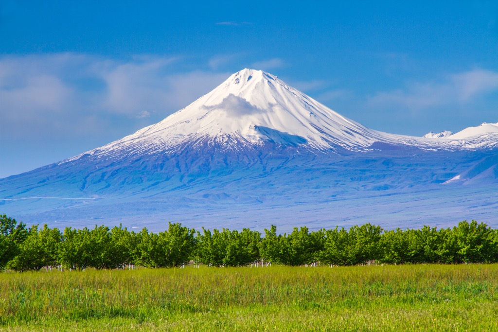
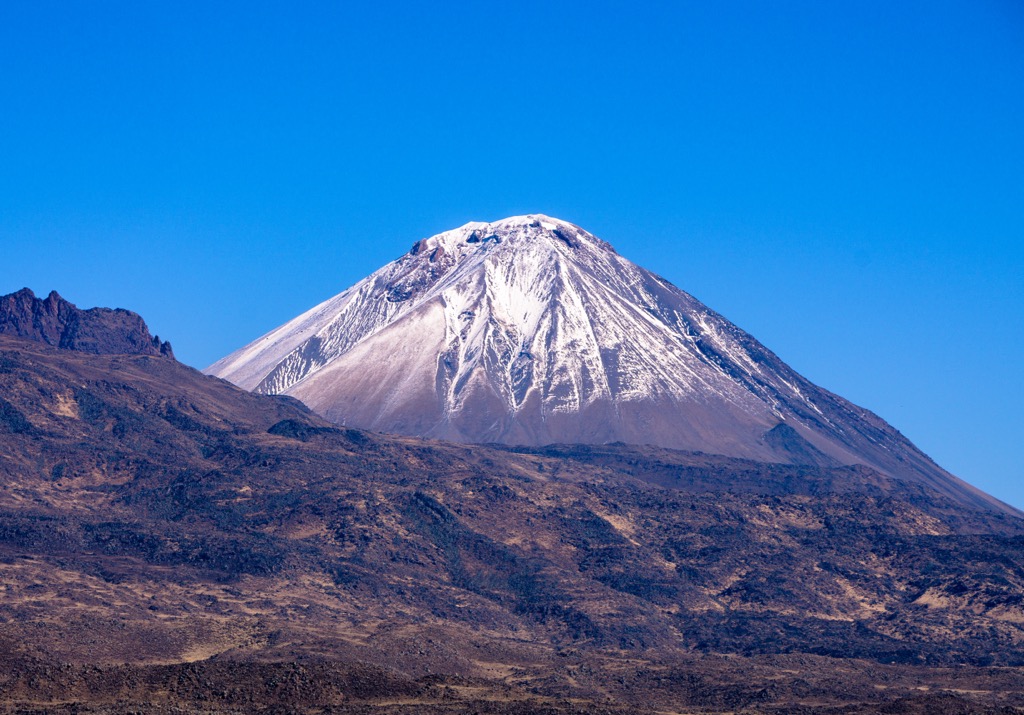
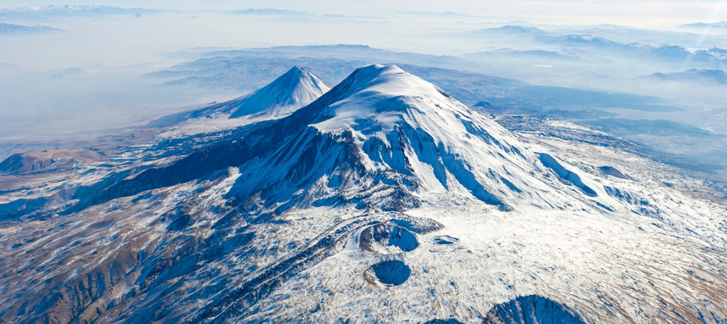
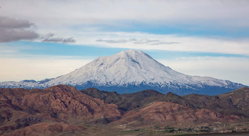
Mount Ararat National Park (Turkish: Ağrı Dağı Milli Parkı) is located in eastern Turkey, near the border with Iran, Armenia, and an exclave of Azerbaijan. Mount Ararat, also known as Mount Ağrı, is a dormant snow-capped volcano and the park's main feature. Some Christians and religious historians believe this peak is where Noah’s Ark rested after the Flood described in the Bible. There are 12 named peaks in the park, with the tallest and most prominent being Mount Ararat (5,137 m / 16,853 ft).

Mount Ararat National Park lies in the extreme east of Turkey. The park is near the border shared with Armenia, Iran, and the Nakchivan exclave of Azerbaijan. The Armenian border lies 32 km (20 miles) north of Mount Ararat, while the Nakchchivan exclave of Azerbaijan and the Iranian border are 16 km (10 miles) east.

Mount Ararat and its two peaks are the main feature of the park, known as Great Ararat (Büyük Ağrı Dağı) and Little Ararat (Küçük Ağrı Dağı). The protected area covers 880.14 sq km (340 sq miles) of land in the Eastern Anatolia Region of Turkey. The northern and eastern slopes of the main peak rise steeply above the Aras River, with the Ararat Massif measuring roughly 40 km (25 miles) in diameter at its base.
Annual snowfall accounts for most of the snowpack within the park. On the northern side of Great Ararat lies the only actual glacier left on the park’s peaks - the ice measures about 10 square km (4 square miles) but is shrinking rapidly due to climate change.
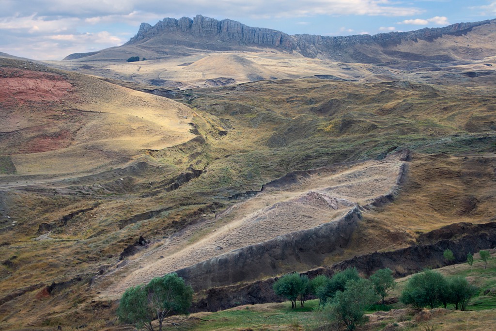
Most of the park is free of tree coverage, marked by barren hills and grass pastures. Alpine tundra characterizes the upper reaches of the peaks, with glaciated terrain found near the summit of Great Ararat.
Prominent streams in the park include Malaryesin, Yakup Prophet, Buzhane, Karahan, and Söhlü Streams. Within the Korhan plateau lies a meteor pit measuring 60 m (197 ft) deep and 35 m (115 ft) wide. The foothills of the peaks are often gentle and rolling, featuring some rocky ridgelines and minimal forested sections.
South of the park lies Noah’s Ark National Park, while the Sarıkamış Allahu Akbar Mountains National Park is to the northwest. Khosrov Forest State Reserve and Dilijan National Park lie to the northeast.

The geological history of the park is deeply intertwined with Mount Ararat. This polygenic compound stratovolcano features two main peaks, Great and Little Ararat. A north-south trending extensional fault separates these peaks and features numerous lava domes and parasitic cones from previous eruptions.
Formation of these peaks began during the early Eocoene and early Miocene as the Arabian platform collided with Laurasia, closing off and eventually eliminating the Tethys Ocean. This tectonic convergence led to the uplift of the East Anatolian-Iranian plateau.
Extensive faulting and folding formed various basins in the plateau. Widespread volcanism lasted from the Mioceene-Pliocene period, reaching its climax between 6 to 3 million years ago. During the Quarternary, volcanic activity diminished to a few regional volcanoes, including Mount Ararat.

Volcanic activity has continued to shape this region, with recent eruptions estimated to have occurred in 2500 BCE, 550 BCE, 1450 CE, and 1783 CE. An earthquake in July 1840 resulted in a phreatic eruption, collapsing glaciers and leading to a landslide that killed nearly 2,000 locals at the mountain's base.
Despite the annual snowfall within the park, the surrounding region receives minimal rainfall, making it difficult for much plant life to thrive.
The plateaus and foothills in the park and populated by low-growing grasses and shrubs. Common plant species include white rose, red clover, wild clover, wild vetch, foxtail, wild barley, rye, and wheat. Small forested patches often support populations of juniper, hornbeam, and birch.

The Süphan lizard, which is endemic to Turkey, can be found in the park. Other animals in the park include the Apollo butterfly, bearded vulture, freckle partridge, rock partridge, wild boar, wild sheep, fox, wolf, and rabbit.
The human history of this land dates back to the nearby city of Yerevan. Humans have inhabited this region since the eighth century BCE, making Yerevan one of the oldest continuously inhabited cities in the world.
Historians call the Armenian plateau the “Epicenter of the Iron Age” as some of the first appearances of metallurgy occurred in the region around 2000 BCE.

King Argishti I of Uratu founded the fortress of Erebuni in 782 BCE, marking the earliest recorded history in present-day Yerevan. Erebuni acted as the military, political, and economic center of Uratu and continued to exist following the fall of Uratu. Various empires and groups ruled over the Armenian highlands over the following centuries.
The Seljuk Turks arrived in the highlands around 1040 CE, eventually conquering much of the peninsula. This rapid expansion culminated in the formation of the Ottoman Empire in 1299 CE. Karluk and Kharizmian peoples began migrating to the region during the 13th century CE as the Mongol Empire advanced.
The Safavids brought the highlands under Iranian rule in 1502, followed by the Ottoman Turks in 1514. Shortly after, in 1516, all of present-day Armenia fell under the rule of the Ottoman Empire. Numerous wars raged over the region as the Iranian Safavids and Ottoman Empire fought for control.
Following World War I, the Sykes-Picot Agreement led to the partition of the Ottoman Empire. Its former territory now features sections of Turkey, Iran, Armenia, Azerbaijan, and Georgia. Turkey established Mount Ararat National Park in 2004.

Some religions believe that Mount Ararat is where Noah’s Ark came to rest following the Flood depicted in the Bible. The connection between Noah’s Ark and Mount Ararat dates back to the 11th century CE.
Mount Ararat is also sacred to Armenians, some of whom believe their ancestors were the first humans to appear following the Flood. A village once lay on the slopes of Mount Ararat, at the site where some believe Noah built an altar.
A monastery for St. Jacob was built above the village to honor his many efforts to summit Mount Ararat while searching for the Ark. The eruption of 1840 resulted in a landslide that destroyed the town and monastery and killed at least 1600 people.
German alpinist Johann Jacob von Parrot completed the first recorded summit of Great Ararat in 1829.

There are minimal hiking routes within Mount Ararat National Park. The main draw is the trek to the summit of Mount Ararat. Anyone wishing to visit the region and attempt the summit must have a licensed guide and acquire a permit. There are numerous established guiding companies, many of which will obtain a permit for those in their group.
Mount Ararat is not considered a technical mountain climb; altitude is the main challenge for climbers. Many of the guiding companies factor in several days for acclimatization.

Many small villages surround the national park, although international visitors will likely want to check out the larger cities. Finding suitable accommodation in the cities rather than the remote villages may be significantly easier.
Yerevan is the capital of Armenia and marks the closest major city to the national park. Situated north of Mount Ararat, Yerevan lies along the banks of the Hrazdan River and has a population of 1.08 million residents.

Present-day Yerevan marks one of the oldest continuously inhabited cities in the world. Common sites include the Cascade Complex, Republic Square, Matenadaran Library, the History Museum of Armenia, and Vernissage.
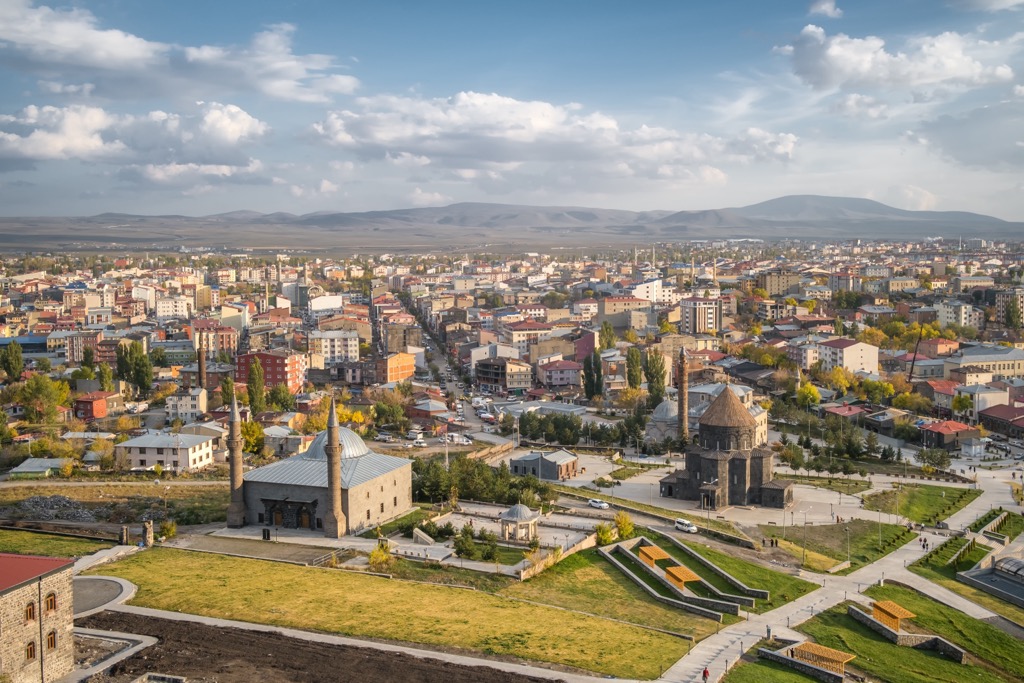
The city of Kars lies northwest of Mount Ararat National Park. Kars is situated on a high plateau in northeastern Turkey and is home to roughly 100,000 residents. During the winter months, Kars provides easy access to the nearby Sarıkamış Ski Resort and Yalnızçam Kayak Merkezi.
Some popular sites include the Kars Museum, Kars Castle, Ani Catherdral, Hasan Harakani Tomb, and the Kafkas Cephesi Harp Tarihi Müzesi. The Ani Ruins, another popular tourist destination, are a short drive east of Kars.


Explore Mount Ararat National Park with the PeakVisor 3D Map and identify its summits.